
More in Uncategorized
-
Uncategorized
Africa World Airlines Donates GH¢100,000 to Labone SHS Endowment Fund
Africa World Airlines (AWA) has donated GH¢100,000 to Labone Senior High School (Labone SHS) to support...
-


Uncategorized
Conversations parents should be having with their kids daily
The role of parenting is a huge task, so much so that many people fail in...
-
Uncategorized
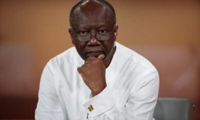
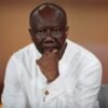
Former Finance Minister Ken Ofori-Atta Declared Wanted By Special Prosecutor
Ghana’s Office of the Special Prosecutor (OSP) has declared former Finance Minister Ken Ofori-Atta a wanted...
-


Uncategorized
‘I Was Saved By God To Make America Great Again’ – Donald Trump Says After Stating That Only Male And Female Gender Will Be Recognized Henceforth
Donald J. Trump was officially inaugurated for his second term as President of the United States...
-

Uncategorized
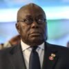
“I Did My Best for Ghana” – Former President Akufo-Addo Reveals
In a heartfelt address during a thanksgiving mass at Accra Ridge Church, former President Nana Akufo-Addo...

Trending